


Path Finding with AR Drone and Mobile Robot in the Campus
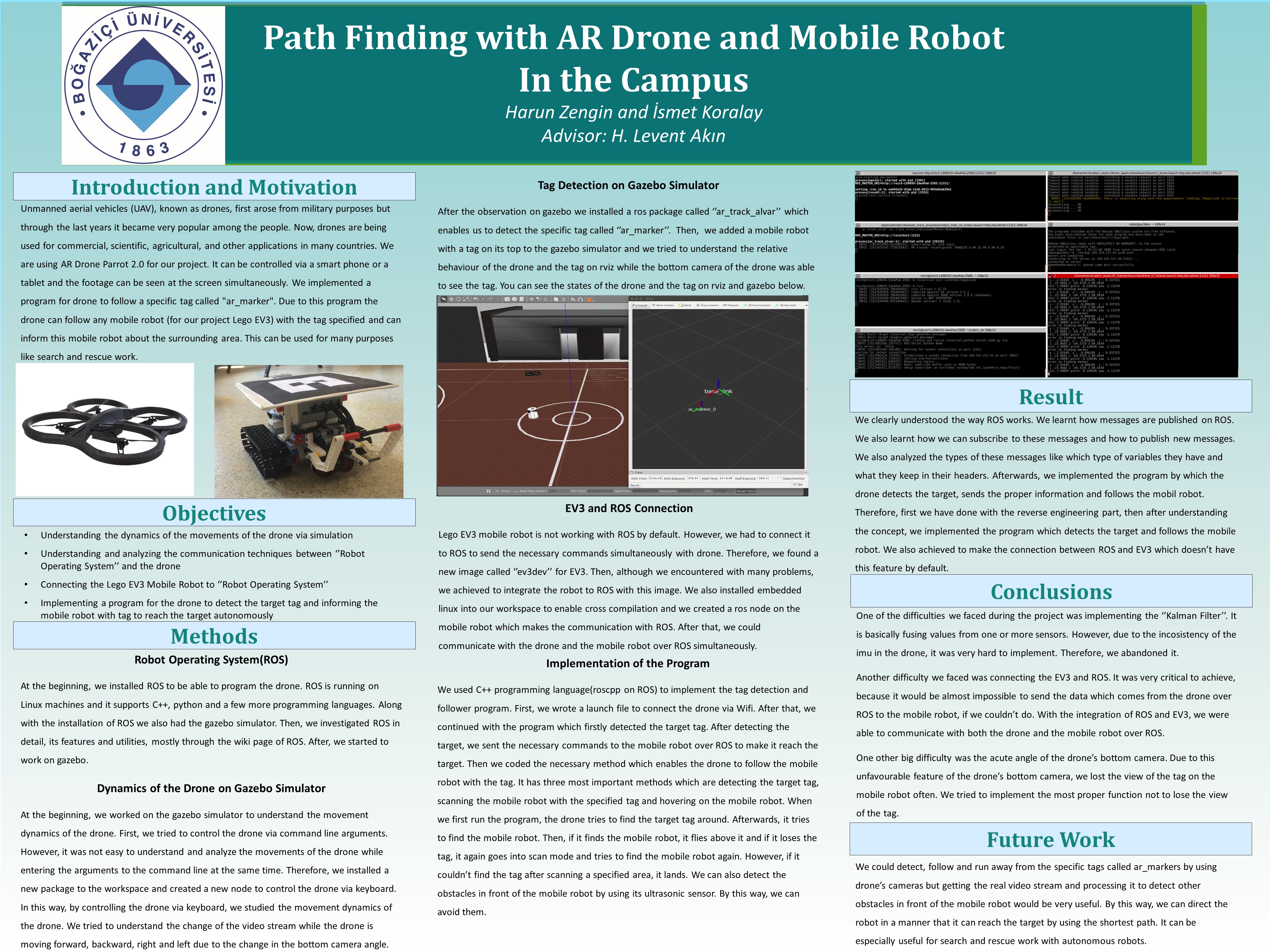
Unmanned aerial vehicles (UAV), known as drones, first arose from military purposes but through the last years it became very popular among the people. Now, drones are being used for commercial, scientific, agricultural, and other applications in many countries. We are using AR Drone Parrot 2.0 for our project. It can be controlled via a smart phone or a tablet and the footage can be seen at the screen simultaneously. We implemented a program for drone to follow a specific tag called "ar_marker". Due to this program the drone can follow any mobile robot (for our project Lego EV3) with the tag specified and can inform this mobile robot about the surrounding area. This can be used for many purposes like search and rescue work.
Project Poster:
Project Members:
Project Advisor:
Project Status:
Project Year:
- Spring